



Christina
Persico RNZ Pacific Senior bulletin editor
Mark Rabago
RNZ Pacific CNMI correspondent
The Commonwealth of
the Northern Mariana Islands (CNMI) governor David Apatang
is advising residents of Saipan, Tinian and Rota to stay
up-to-date with forecasts as Typhoon Bavi
approaches.
An update just after midnight Friday from
the National Weather Service in Guam said satellite imagery
showed Bavi as a very broad, strengthening storm, forecast
to become a typhoon within the next 24 hours.
Bavi is
forecast to continue strengthening over the next few days as
it moves west-northwest toward the Marianas.
The storm
could potentially pass anywhere from south of Guam to north
of Anatahan, in the north of the CNMI, and there will be
adjustments to the forecast track.
A zone forecast for
the Marianas stated tropical storm conditions are possible
on Sunday night for Saipan, Tinian and Rota, with typhoon
conditions possible on Monday.
“Seas are expected to
start building Saturday, as swell from Bavi approaches the
Marianas. Seas are expected to become hazardous as soon as
Saturday afternoon,” the forecast said.
The storm has
prompted officials to cancel the 80th Liberation Day
parade.
It comes as some residents are still without
electricity following super typhoon Sinlaku.
Advertisement – scroll to continue reading
Sinlaku
battered the Marianas and Guam in April, causing widespread
devastation to local infrastructure and the economy, and wiping
out up to 60 percent of the livestock on
Saipan.
The
CNMI Public School System – the main organisation that runs
all the free, government-funded schools – decided
to end the 2025-2026 school year early instead of
reopening campuses due to the devastation.
It is only
been a couple of weeks since the US Army Corps of Engineers
announced on 22 June that its
temporary power planning and response team had completed the
deinstallation of all emergency generators used to
support critical infrastructure after
Sinlaku.
Residents prepare
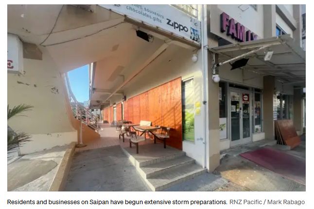
Residents and
businesses on Saipan have begun extensive storm preparations
ahead of what could become the Marianas’ second super
typhoon in just over two months following Super Typhoon
Sinlaku.
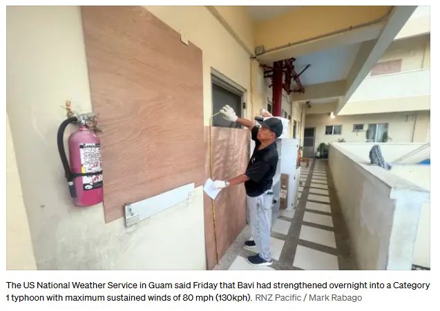
Long
lines formed at gasoline stations Thursday as motorists
topped off their fuel tanks, while homeowners flocked to
hardware stores for plywood, storm shutters, and other
emergency materials.
Supermarkets and other retailers
also saw residents stocking up on groceries, bottled water,
and other essential supplies, while many homes and
businesses were already being boarded up in anticipation of
the storm.
The US National Weather Service in Guam
said Friday that Bavi had strengthened overnight into a
Category 1 typhoon with maximum sustained winds of 80 mph
(130kph), and that conditions are “optimal for rapid
intensification,” which could begin immediately and continue
over the next one to two days.
As of 7am local time,
Friday, the Joint Typhoon Warning Center placed Bavi about
760 miles (1223 km) east of Guam and 715 miles (1151 km)
east-southeast of Saipan, moving west-northwest at 14mph
(22kph).
Under the influence of a subtropical ridge to
its north, the cyclone is expected to turn westward before
resuming a west-northwest track toward the
Marianas.
Warning Coordination meteorologist Landon
Aydlett said the latest forecast continues to depict “a grim
outlook” for the Marianas, particularly Saipan and Tinian,
with current projections bringing a super typhoon near or
just south of Tinian by mid- to late Monday
morning.
The National Weather Service said the current
forecast still points to Bavi passing through the Marianas
after undergoing rapid intensification over the next two
days.
However, Aydlett stressed that the forecast is
not a guarantee. He said the storm’s track could still shift
south toward Guam or farther north, while changes in its
speed and intensity remain possible over the next two to
three days.
A direct hit is not guaranteed for any
island, but remains a distinct possibility, particularly for
Saipan and Tinian.
The National Weather Service said
all residents of Guam and the CNMI should prepare for at
least tropical storm-force conditions.
Islands closest
to the storm’s centre, or those that receive a direct hit,
could experience significantly stronger winds, destructive
surf, torrential rain and dangerous conditions.
The
agency described Bavi as “a significant threat for all of
the Mariana Islands” and urged people to take steps now to
protect life and property while closely monitoring official
forecasts.
A special weather statement also remains in
effect for Chuuk, Pohnpei and Kosrae in the Federated States
of Micronesia, where Bavi is expected to pass to the
north.
Forecasters warned those islands could still
experience surging west winds, thunderstorms and periods of
locally heavy rainfall as the system moves through the
western
Pacific.
New Zealand’s public broadcaster, providing comprehensive NZ news and current affairs, specialist audio features and documentaries.
Radio New Zealand is a Crown entity established under the Radio New Zealand Act 1995. Radio New Zealand News are vital elements in our programming, providing impartial news and information to New Zealanders every day. Radio New Zealand (RNZ) provides listeners with exciting and independent radio programmes in accordance with the Radio New Zealand Charter.

